Thursday, September 9, 2010

Fifth and Sixth Minden Flights of 2010

I paid my fourth visit of the 2010 soaring season to Minden, NV and flew on Saturday and Sunday, August 14-15, 2010 with SoaringNV in their Schempp-Hirth Duo Discus X.

Once again, I flew with Kenny Price and Devin Bargainnier. This time I flew with Devin on Saturday and Kenny on Sunday.

 Day 1 - Saturday, August 14, 2010

Devin and I decided that we would attempt to fly to Mount Whitney, and farther south if possible. It was not possible. Not only to fly farther south of Mount Whitney, but the day was not strong enough to even get there.

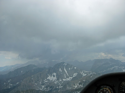
Although it was mid-August, there was still a surprising amount of snow in the Sierras.


We made our way to the south, down to Mammoth Lakes Ski Resort south of Mono Lake.


This is looking east. The large lake in the distance is Lake Crowley and Mammoth Lakes Airport is between it and the small lake, running parallel to HWY 395. Boundary Peak is the the white peak to the far east on the White Mountain Range (see last post).


This is Blood Mountain. Hmmm, I wonder why they call it that.


As we rounded Blood Mountain, another spectacular sight came into view (which happens every time I go down the Sierras!). A vein of gray granite infused into the red mountain at the right in the photo provided an interesting contrast.


Here it is as we got closer and following it to the west.


As we crossed the the next ridge, the most beautiful alpine lake I had ever seen came into view. It is Dorthy Lake. I thought I was seeing it for the first time. As I researched the name of this lake, I realized that I had seen it last year from a different perspective.


Dorothy Lake is at the bottom of this photo, and Lake Genevieve is to the upper left.


This is a photo from the first time I saw Dorothy Lake. It was last year, when I flew with Gavin Wills on my first ever trip to Mount Whitney during SoaringNV's first cross-country camp. This view is from much higher, and from the east looking west. Dorothy Lake is the large lake to the left and Lake Genevieve is the lake at the right of the photo. The smaller lakes above Lake Genevieve are Edith Lake and Cloverleaf Lake. This is my favorite soaring photo I have taken to date and serves as my desktop background.


We crossed a saddle in the granite infused mountain and then began a search for another "gas station". I had to remind Devin of the three rules of mountain flying!


We united with Mike Harrbison, a.k.a. "Mountain Mike" here and set-up for a photo opportunity. Mountain Mike is one of the most experienced fliers of the Sierras ever, and hence how he earned his nickname.


We continued together a little farther south, and then decided that we were not going to attempt Mount Whitney this day. We turned around and began the trip north back to Minden. Here we are at Tioga Pass (HWY 120), which leads out of Yosemite National Park and connects with HWY 395 near Mono Lake. The lake at the bottom of the photo is Ellery Lake and the lake at the top of the photo is Tioga Lake.


We continued north and found that the conditions were right to do something I had never done before. Fly into the Lake Tahoe basin. The big cumulus cloud in front of us would, in theory, provide us enough gas in the tank to venture over to Emerald Bay at the southwest corner of Lake Tahoe.


Here's a few shots of South Lake Tahoe as we are "filling up" before making the trip to Emerald Bay.


We actually flew farther west of Emerald Bay. These photos were taken as we returned to the "gas station" before we headed back to Minden.


Here's our flight trace from See You.


And here it is in Google Maps.


Day one totals: Flight time - 4.5 hours, Distance covered - 344 miles

Day 2 - Sunday, August 15, 2010

I didn't take any photos during this flight. Kenny and I flew down to the ghost town of Bodie, and then started towards Mount Grant. However, the cloud bases at Mount Grant were much lower than our current altitude. So we decided not to continue all the way there. Instead, we returned to the Pinenuts and continued north up to Rawe Peak. We then ran the length of the Pinenuts back down to the south end and decided to cross the Carson Valley to the Sierras.

We found no lift on southbound journey down the Pinenuts, nor during the first half of the crossing of the Carson Valley. We had travelled about 30 miles since leaving the last gas station and were starting to get low. It looked like the flight was coming to an end when we found a mild thermal that took us back up to ~12,500 MSL. So with all this new found gas we continued over to the Sierras and, for the second day in a row, flew into the Lake Tahoe basin before returning to Minden.

Here's our flight trace from See You.


And here it is in Google Maps.


Day two totals: Flight time - 4.4 hours, Distance covered - 316 miles

Another very special thank you to Kenny, Devin, and SoaringNV!

Wednesday, July 28, 2010

Third and Fourth Minden Flights of 2010

I paid my third visit of the 2010 soaring season to Minden, NV and flew on Saturday and Sunday, July 17-18, 2010 with SoaringNV in their Schempp-Hirth Duo Discus X.  The weather on my first two trips was less than optimal, and thus the flights were just a little more than local flights.  We did get out of the Carson Valley on both occasions, but we did not go far.

The weather was much improved on the third visit and made for two days of great cross-country flying.  I flew with Kenny Price, my instructor from Williams, CA, on Saturday and Devin Bargainnier on Sunday.

Day 1 - Saturday, July 17, 2010

Kenny and I decided that we would attempt to fly to Boundary Peak.  Boundary Peak is the northern most peak on the White Mountain Range, which, along with the Inyo Mountain Range, forms the eastern edge of the Owens Valley.  At 13,141 feet, Boundary Peak is the highest peak in the state of Nevada and is just east of the California/Nevada border.  From there, we would assess the conditions and decide whether or not to continue the flight to the south along the Whites.

We got onto the Pine Nuts in relatively short order and headed south out of the Carson Valley.  The day was strong and the sky was filled with gorgeous cumulus clouds, which marked the lift and showed us the way south.  The route we took was Mt. Siegel to Mt. Patterson to the old ghost town of Bodie, then east of Mono Lake and south to Boundary Peak.

Here we are a little more than two hours into the flight and arriving at Boundary Peak.


The town just to the right of the crop circles in the next photo is Benton, CA.  It is also known as Benton Hot Springs because of the Hot Springs it features.  Benton was once a small mining town with up to 5,000 inhabitants in its heyday (circa 1860s).  In 2000, the census population was only 196.


We could see that the conditions had already over-developed to the south along the Whites, and there was rain at White Mountain Peak about 15 miles to the south.  So we decided not to progress further south and instead began our return to Minden.

Our return path was almost the same as the path we took down.  Here we are heading north, to the east of Mono Lake.


Here we are at a "nice, clean gas station" 21 miles south of Hilton Ranch and we are climbing back up to 16,000 feet before continuing the journey home.  Those of you who have read my posts before know that I use "gas station" as a euphemism for an area of lift that we use to climb and hence, "put gas in the tank".  The addition of  the adjectives "nice" and "clean" means that I also found this as an opportune time to....ahem...."relieve myself".  Those of you with wives know what I mean.


We took a small sight seeing detour over Monitor Pass to view the East Fork of the Carson River and the small Sierra town of Markleeville before returning to Minden.

Here's our flight trace from See You.


And here it is in Google Maps.


Day one totals: Flight time - 4.3 hours, Distance covered - 308 miles

Day 2 - Sunday, July 18, 2010

Devin and I decided we would try for Mount Whitney on Sunday.  Mount Whitney is the highest summit in the contiguous United States with an elevation of 14,505 feet.  We made it there but, unfortunately, we didn't quite get back.

We followed pretty much the same path south that Kenny and I took on Saturday.  But we got low at Mount Siegel early in the flight and had to fly close to the mountain to find lift.  Devin quizzed me, "What's the #1 rule of mountain flying?"  My mind raced through the cobwebs of my early flight instruction.  Let's see... don't fly on the lee side of the mountain, um... don't approach the mountain at 90 degrees, um....  Devin interrupted my thought process and proclaimed the answer he was seeking, "Don't hit the mountain!"  And then he continued, "And the #2 rule of mountain flying is, don't hit the mountain! And the #3 rule of mountain flying is, don't hit the f---ing mountain!"  Words of wisdom from the mouths of babes!

Here we are at Mount Patterson.  Note the video camera secured to the left wing.  I still haven't seen the video that the camera took.  You might ask how is the camera secured to the wing?  Come on, we're guys!  Duct tape of course!


We almost had to land out at the Sweetwater airstrip before Devin found a great thermal that took us back up to 15,000 feet.  Then we resumed the flight to the south to Bodie where we found a good "gas station" which gave us the height we needed to fly right over the top of Mono Lake to Glass Mountain.

From there we proceeded down the center of the Owens Valley to just north of Bishop, where we headed west to the Sierras.  The Sierras form the western edge of the Owens Valley.  Flying along the Sierras is very scenic (See my posts from last year).

Here's a beautiful lake shot.


We were still about 25 miles north of Mount Whitney when we encountered rain.  Mount Whitney is to the left of center, beyond the rain in the next shot.


More scenic shots as we continued to the south.


We finally arrived at Mount Whitney, but below it.  It is the highest peak in the center of this photo.


We continued a little further south and did some "rock polishing" in the hope of finding a "gas station" which would get us high enough to summit Mount Whitney.

I reminded Devin of the #1 rule of mountain soaring.


And the #2 rule of mountain soaring.


And whatever you do, don't forget the #3 rule of mountain soaring!


However, we did not have any luck.  We would not summit Mount Whitney this day.  From here we crossed the Owens Valley, over the town of Lone Pine, to the Inyo Mountain Range to the east.  We proceeded north under a fantastic cloud street that took us all the way to Boundary Peak at the north end of the White Mountain Range with only one stop at a "gas station".

From there we could see that we had quite the challenge ahead of us as the sky was blue all the way back to Minden.  We would not have the benefit of clouds showing us the way to get home.

We proceeded north while keeping landing options available to us.  First, Hawthorne airport at the south end of Walker Lake.  Then Hilton Ranch airstrip to the west of Mount Grant.  And finally, we went to Gimmey's Bowl where a weak thermal gave us the height we needed to almost get back.  Almost.  All we needed was one more thermal to get us over the Pine Nuts and back to Minden.  But did we find one?  No.

So we landed at Rosachi Dusters airstrip in the Smith Valley, on the east side of the Pine Nuts.  But we were not the first to land there this day.  A pilot visiting from Japan had already landed out in a Schempp-Hirth Discus B.  These photos were taken after we had already helped each other push both gliders into position for aerotow retrieves.


I called Fred at SoaringNV on my cell phone shortly before we landed and informed him of our predicament, and he arranged to have a tow plane come get us.  It arrived about 45 minutes later.


We helped launch the Japanese pilot and then waited for the tow plane to return for us.  But who would run our wing?  The wings of the Duo Discus X are wider than the runway and the terrain off the runway is rough.  Devin threatened to make me run the wing and he would send an auto retrieve for me!  I adamantly objected to this suggestion.  So we improvised.


But the first attempt failed.  The wing came off the tire and fell onto the dirt as the tow plane began to move forward.  Devin pulled the release before the wing collided with the asphalt.  So we set up for take two.  This time with the wing and tire starting on the asphalt.


Devin and the tow pilot used the tow rope to pull the tow plane back into position.


Fortunately, the wind picked up. This would help give us control authority much sooner. We coordinated with the tow pilot to rev-up the engine while standing on the brakes before releasing them so we would have a much more sudden forward acceleration from the start.  Hey, what's that gas thing to the left of the windsock for?


And this time it worked perfectly!


Here we are climbing out of the Smith Valley.  We did a 360 degree climbing pattern before heading northwest to climb over the Pine Nuts and return to Minden.


Here we are coming in to land at Minden at the same time as the tow plane.  We are landing on RWY 30 and the towplane is landing on RWY 30R (a dirt strip).


Devin blamed me for our land-out!  He claimed that our late start, because I couldn't get my "stuff" together, was the reason we landed out.  I blame the wingtip camera for the extra drag it caused!

Here's our flight trace from See You.


And here it is in Google Maps.


Day two totals (excluding retrieve): Flight time - 6.2 hours, Distance covered - 455 miles

A very special thanks to Kenny, Devin, and SoaringNV for making these incredible flights possible for me!