Sunday, June 3, 2012

Into Thin Air - Soaring To FL 250!

I almost cancelled my first trip to Minden, NV this season! What a mistake that would have been!

I was scheduled to fly with Devin Bargainnier in SoaringNV's Schempp-Hirth Duo Discus X on Saturday and Sunday, May 26th and 27th, 2012 (Memorial Day weekend). I had made all the arrangements several weeks in advance and as the trip approached, it became apparent that it was going to coincide with a late-season winter storm. A few days before the trip I was seriously considering rescheduling, but I decided to go ahead as planned as the forecast was indicating that the storm would be moving out by Saturday and I was thinking that it could be good post-frontal conditions.

When I left my house Friday morning to begin the journey, the Sonora Pass (my primary route) was closed due to snow and chains were required over the Carson Pass (my alternate route). So I grabbed my bag which contains all my cold weather gear just in case I was to encounter trouble on the drive over. I had no troubles getting there, just a bit of a slog getting over the Carson Pass. Chain restrictions had been lifted, but it was still snowing. I was stunned by the view that greeted me as I entered the Carson Valley and Highway 88 turned to run parallel with the Sierras. The storm was still raging in the Sierras and its clouds were spilling over the eastern escarpment like a series of waterfalls!


I was extremely disappointed Saturday morning when I awoke and the storm was still firmly planted over the Carson Valley. Cloud bases were low and it was raining in the Pine Nut mountains to the east and snowing in the Sierras to the west. Devin and I revised our meeting time at the airport for noon in the hopes that the storm would clear a little and provide more flyable conditions.

Things had not improved much when we met at noon. We assessed the situation and discussed our options. We could fly and most likely we would have a soaring flight as there was obviously plenty of energy in the atmosphere. But we probably weren't going to be able to get out of the Carson Valley because of the low cloud bases and a TFR in place at the south end of the valley due to a fire by Topaz Lake. We hemmed and hawed and Devin tried to convince me that I would be better off going fishing on Saturday and coming back on Sunday. I was tending to agree with him, but I wasn't ready to throw in the towel. I convinced him to wait another half hour before we made the final decision.

At 2:15 we went out front of the SoaringNV hangar and looked towards the Sierras to the west. I was already thinking about where I was going to go buy my annual fishing licence. Devin immediately proclaimed "let's go up in the wave". I looked at him incredulously and asked "really, do you think it's working"? All I saw was the storm clouds hanging about the sky. I saw no evidence of the classic lenticular clouds that usually mark the wave. He assured me that it was and I told him I'd be ready to go in 10 minutes. I was really thankful that I had grabbed my cold weather bag at the last minute!

We took off shortly after 2:30 and towed to the west. We encountered the rotor as expected, which was a really good sign that the wave was indeed working. I struggled to maintain position behind the tow plane as we towed through the rotor. It's like trying to maintain formation flight in a clothes dryer! Soon the turbulence was replaced by the smooth laminar flow of the wave and we released at about 9,000' (all altitudes are given in MSL).

Here we are shortly after release at about 10,000' and just beginning our climb in the wave. Again, absent were the tell-tale smooth lenticular clouds that I have come to expect with the wave and in their place was just a patchwork of ragged cumulus clouds.


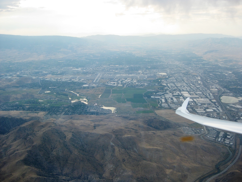
Lake Tahoe came into view as we climbed above the cumulus clouds.


At this point we are climbing through 13,000' and the lift was strong enough that Devin presented me with two options. We could climb to 18,000' and stay at or below that altitude and proceed north to Reno, or we could see if the wave window could be opened allowing us to climb higher than 18,000'. I told Devin that it had always been one of my goals to one day climb above 20,000' in the wave. Devin radioed down to the SoaringNV office and asked them to call Oakland Center, the ATC center responsible for the area, and inquire about the possibility of opening the wave window.


It was interesting that the wave system was working differently on two levels this day because of a shift in the wind direction with altitude. The lower level was marked by the storm clouds, and the upper level was marked by the classic lenticular cloud at an angle to the lower level. The upper level seemed so much higher than us here that I somewhat jokingly stated to Devin that we might be able to climb into the upper level of the wave. Little did I know at the time that we were about to do just that!


A few minutes later the office called us back and informed us that the wave window would be opened at 3:10 after an airliner that was passing above us was clear of the area. The window would be open to 28,000' until 6:00.

Here we are after the window was opened and we are climbing through 20,000'. At one point above 20,000' we looked down and saw a Southwest jet beneath us heading to Reno.


We set our preliminary goal altitude at 25,000'. We would monitor the strength of the lift as we proceeded in the climb to determine if we would reach our goal, or go even higher.

Here we are climbing through 24,000' on a northwesterly heading. We are almost at the same height of the top of the lenticular cloud to our right, and we are way above all the cumulus clouds to our left. It truly felt like being on top of the world!


We reached our goal height of 25,000' in just a little more than an hour after takeoff. We had averaged a climb rate of about 300-400 fpm until about 24,500'. The climb rate dropped off to about 100 fpm for the last 500' of the climb and we decided we would not try to go higher. Spending excessive time at such extreme altitudes is just asking for trouble if something should go wrong with the oxygen system.

Note that the mechanical altimeter shows just below 25,000' and the more accurate GPS altimeter is reading 25,029'. We actually reached a maximum altitude of 25,060' before we began our descent.

The outside air temperature at this altitude was -40 degrees. You might ask, was that Fahrenheit or Celsius? And my answer would be, yes. That is because -40 degrees Fahrenheit equals -40 degrees Celsius. It is the only temperature that is the same in both scales.


As we began our descent, Devin cautioned me that we would not want to come down too quickly and put the glider through thermal shock as we descended into warmer air. If we did, the canopy could break. So we set the airspeed at 60 knots and I opened the dive brakes half way. This gave us our desired descent rate of 400-500 fpm. After a while, I released my grip on the dive brake handle slowly to see what it would do. Would it stay put, slam shut, or open fully? The dive brakes stayed deployed half way.

Everything was going well as we descended through 23,000' when all of a sudden there was a loud BANG! Surprisingly, this did not cause me undue concern as I immediately concluded that the dive brakes had slammed shut. But a quick look out and they were just where they had been all along. That's when Devin asked, "What the hell was that?" NOW I was concerned! A few seconds later Devin spotted what had caused the explosive noise. The canopy had broke! The very thing we were carefully trying to avoid had happened. You can see the crack in this photo. It is about 2-3 inches long running from the rear bottom of the vent window all the way to the bottom of the canopy.


The rest of the descent was uneventful. Once we got below 18,000', we encountered another glider climbing up in the wave. Can you spot it in this photo? 


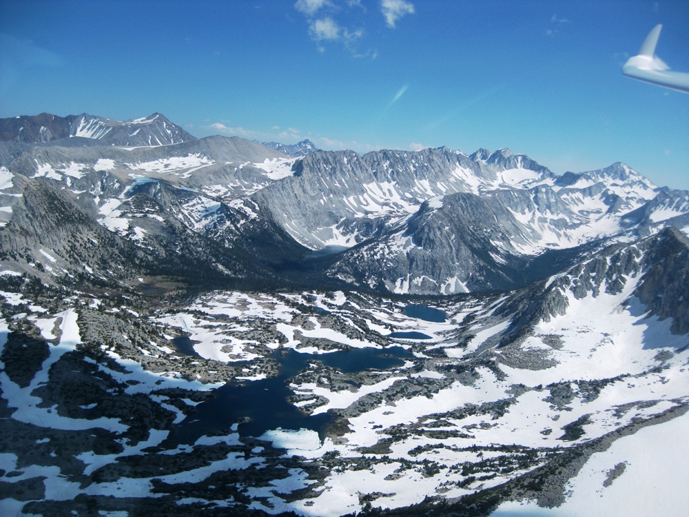
We decided to fly north and went as far as Carson City. We then returned to the Carson Valley and flew around the valley for a little while admiring the views that the storm system provided.


After two hours in the air we were both sufficiently cold that we decided to call it a day.

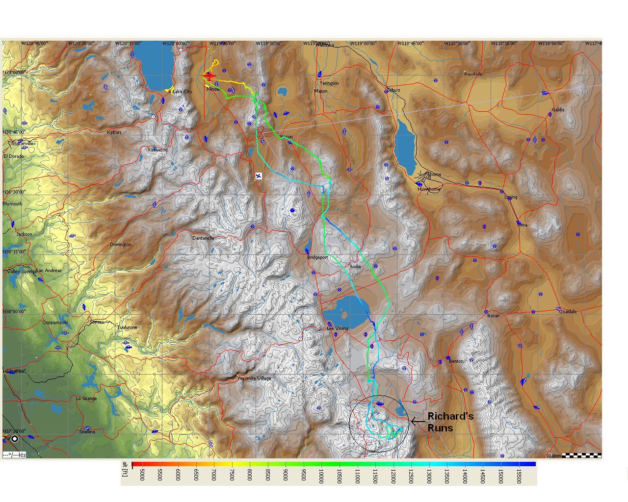
I often post the GPS flight traces from my flights showing our flight route. However, it seems more appropriate to include the altitude plot from this flight.


In hindsight, I'm really glad I didn't listen to Devin and go fishing this day. I would have missed out on one of the best flights of my soaring career to date. Besides, the rivers are running high, fast, and cold this time of year. That could have been dangerous!

A very special thanks to all of the staff at SoaringNV who made this flight possible. Brad and Spencer for preparing the oxygen system. Spencer for getting the glider to the line and getting us launched. Patrick for the tow. Elizabeth for contacting Oakland Center to open the wave window. And most importantly, Laurie for not being too mad at us for breaking her glider a little! It truly takes a team effort to make a flight like this possible!

Sunday, September 18, 2011

Fourth Minden Flight of 2011

I paid my third visit of the 2011 soaring season to Minden, NV and flew on Saturday, September 10, 2011 with Rick Walters, a widely known soaring competition pilot. We flew together in SoaringNV's Schempp-Hirth Duo Discus X.

The forecast was for a fantastic day of soaring, and the day delivered! We originally planned to fly all the way around Lake Tahoe (which is rarely viable) but the day over developed early and the entire west shore of the lake was under thunderstorms by the time we arrived on top of the Sierras to the east of the lake. After spending an hour trying to make the original plan work, we decided to fly to the north. As the flight progressed, we kept setting our goal farther and farther north as the day was exceptionally good. Little did we know that we would end up flying all the way to Mt. Lassen...... and almost back to Minden!

These photos show the over development to the northwest and the west of us, respectively, when we were north of Truckee and our goal was to fly to Susanville, CA.


The lift line that we were in favored a more westerly route which took us on a heading to Lake Almanor and we revised our goal to the town of Chester on the northwest corner of the lake.  Here we are just to the south of Lake Almanor.


This is the town of Chester. The Chester airport is plainly evident in the photo.


Even before we arrived at Chester, we could clearly see that Mt. Lassen was well within reach even though it was almost another 20 miles to the northwest of us and we would have to cross a big blue hole to get to the next gas station. We decided to go for it!

This is Horseshoe Lake. Its symmetry caught my eye and reminded me of one of those Rorschach inkblot images! If you look closely, you can see streaks of ice/snow/hail (some form of frozen water) going by. It always amazes me when you're sitting in an enclosed cockpit and the stuff still finds someway to get in! I could feel it hitting my legs.


We arrived at the Mt. Lassen gas station after a seemingly endless period of flying through heavy sink and filled up before making our final assault on the mountain.


We circled the summit several times as the mountain itself was putting more gas in the tank than it was taking out. In the photos that follow you can see the lava field that flows from the summit, the switchback hiking path that hikers follow to the top, and the parking lot at the trail head.


We bid Mt. Lassen adieu and began our return journey to Minden. Here we are passing the peninsula of Lake Almanor. At this point it seemed that we were going to have plenty of lift to get us back home.


Here we are passing Honey Lake. Or, more appropriately, what's left of it as evaporation in the summer reduces it mostly to an alkali flat.


It was shortly after leaving Honey Lake that we looked down the road and we could see the gas station attendant holding a sign that was reminiscent of the 1970's gas shortage days "Sorry, out of gas"! We realized that we needed to divert our course out to the east to a mountain simply known as 7990 (so named for its altitude on the sectional map!).

Fortunately for us, 7990 was still pumping gas and we filled up as much as we could before continuing on our new, more southeasterly, heading which took us to the vicinity of Air Sailing Gliderport which can be seen in this photo. Pyramid Lake is to the east of the gliderport, on the other side of the Virginia Mountain Range.


We stayed in the vicinity of Air Sailing in a weak thermal as we contemplated our next move. Continue on into the unknown, or go land at Air Sailing? Tough call, as we knew they were having a barbecue at Air Sailing that night!

Ultimately we decided to try to get back to Minden. Here we are passing to the east of Reno/Tahoe International Airport. Rick had contacted them over the radio and informed them that we might have to overfly their airspace. We had been listening to them reporting our position and altitude to the arriving and departing airliners.


In the end, we stayed to the east of the airport and hoped for one more thermal as we continued south toward Minden. One more thermal, just a splash of gas, and we would be home free! But could we find it? No.

We crossed the Virginia Mountains and flew right over Virginia City as we headed to Carson City. The "V" in this photo is right above Virginia City.


Once we arrived at Carson City, Rick demonstrated the resilience of a great competition pilot and continued to search for that one last elusive thermal that would get us home. To no avail however, and we landed at Carson City. We only had to wait about 15 minutes before the tow plane arrived to tow us back to Minden.

Those of you who have been following this blog know that the flights I have written about here were primarily flights to the south of Minden. Going that far to the north was a brand new experience for me. The flight lasted 5.6 hours and we covered about 350 miles.

My thanks go out to Rick and SoaringNV for another fantastic soaring experience!

Saturday, July 30, 2011

Third Minden Flight of 2011

I paid my second visit of the 2011 soaring season to Minden, NV and flew on Saturday, July 16, 2011 with Devin Bargainnier of SoaringNV in their Schempp-Hirth Duo Discus X.

I made this trip with a heavy heart as my Dad, Richard, had just passed away on July 3. It was somewhat of an untimely death (are they ever timely?), but not completely unexpected as Dad's health was in decline. In fact, my parents were in the process of moving to a lower elevation because of Dad's health when he died. So, after spending two weeks at Mom's house getting affairs in order, things were finally stable enough that I took a much needed break and went to do what I know Dad would have wanted me to do.

We had hoped to fly to Mt. Whitney on this day, but the day was not strong enough and we got a relatively late start. So instead, we flew to the south and made it a little past the Mammoth Mountain Ski Area.

Once we arrived, we could see that the lift line extended a little west into the Sierras. So we took this opportunity for a little sight seeing excursion. We knew that we wouldn't have much opportunity for extended dances in the Sierras as the lift markers were few and scatterd. In addition, the cloud bases weren't much higher than the mountain peaks. But we made two runs into the Sierra's separated by a return trip to the "gas station" to fill-up again before the second run. I have named these "Richard's Runs" in honor of my Dad.

I will dispense with my usual diatribe and let the photos tell the story of Richard's Runs. I'll just say to pay particular attention to the high-speed, low pass over the frozen lake with the turquoise blue shoreline. Enjoy, I know he did!


All too soon, Richard's Runs came to an end as we knew we would have to start back to Minden while the "gas stations" were still open. Here we are filling up at the Mammoth Lakes gas station right by the airport and Lake Crowley before beginning the journey back.


We proceeded north and filled up again at the southeast corner of Mono Lake. We put enough in the tank this time that we could make a beeline straight across the lake and head for the next gas station, which the sign said was forty miles away near Mt. Patterson. The wind on the lake was strong enough that its direction is clearly evident.


We approached the ghost town of Bodie, which I had flown over a number of times but had never taken a picture of as we were always too high.  In the first photo, Bodie is ahead of us on the right.  And in the second photo, it is near the wingtip.


It turns out that the Mt. Patterson gas station was closed when we arrived, but fortunately we found one still open near Gimmey's Bowl just a few more miles up the road. And it had a nice clean restroom to boot! That was all the gas we needed to get back home.

Here's our flight trace from See You.


What a wonderful flight to celebrate my Dad's life! The flight was 4 hours and 20 minutes in duration and we covered about 350 miles. But the 20 minutes that were Richard's Runs were definitely the highlight of the journey!

Epiblog

There aren't enough words to tell you what a wonderful person my Dad was. He was at times my mentor, my coach, my role model, my cheerleading squad, and most of all, my friend. I will consider myself successful if I can be half the person he was in life.

We only took to the skies together once, and he seemed to really enjoy it. I look forward to many more great flights with him in the future as I know he will always be with me.