Sunday, September 18, 2011

Fourth Minden Flight of 2011

I paid my third visit of the 2011 soaring season to Minden, NV and flew on Saturday, September 10, 2011 with Rick Walters, a widely known soaring competition pilot. We flew together in SoaringNV's Schempp-Hirth Duo Discus X.

The forecast was for a fantastic day of soaring, and the day delivered! We originally planned to fly all the way around Lake Tahoe (which is rarely viable) but the day over developed early and the entire west shore of the lake was under thunderstorms by the time we arrived on top of the Sierras to the east of the lake. After spending an hour trying to make the original plan work, we decided to fly to the north. As the flight progressed, we kept setting our goal farther and farther north as the day was exceptionally good. Little did we know that we would end up flying all the way to Mt. Lassen...... and almost back to Minden!

These photos show the over development to the northwest and the west of us, respectively, when we were north of Truckee and our goal was to fly to Susanville, CA.


The lift line that we were in favored a more westerly route which took us on a heading to Lake Almanor and we revised our goal to the town of Chester on the northwest corner of the lake.  Here we are just to the south of Lake Almanor.


This is the town of Chester. The Chester airport is plainly evident in the photo.


Even before we arrived at Chester, we could clearly see that Mt. Lassen was well within reach even though it was almost another 20 miles to the northwest of us and we would have to cross a big blue hole to get to the next gas station. We decided to go for it!

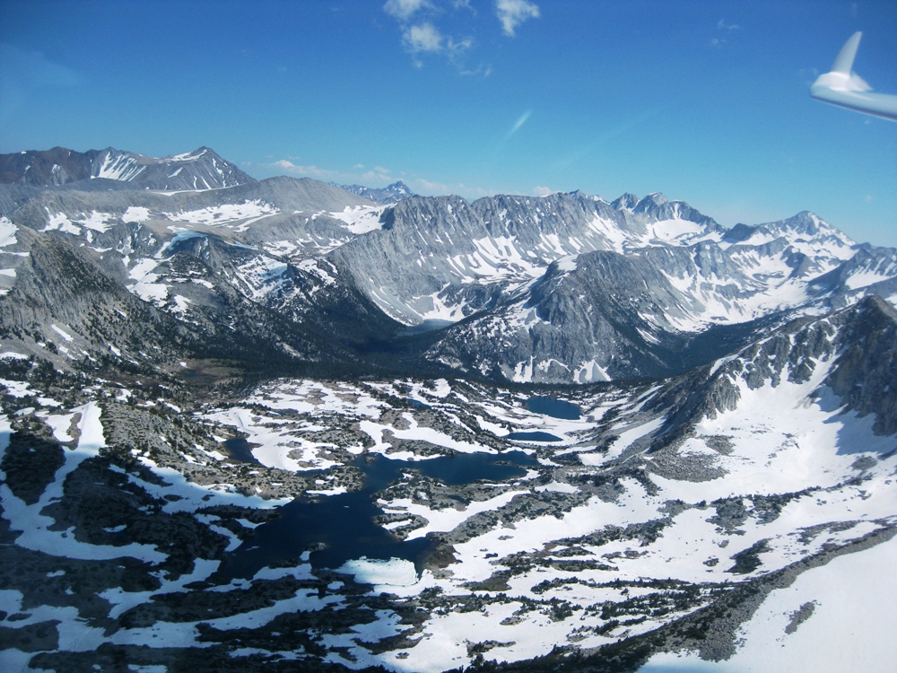
This is Horseshoe Lake. Its symmetry caught my eye and reminded me of one of those Rorschach inkblot images! If you look closely, you can see streaks of ice/snow/hail (some form of frozen water) going by. It always amazes me when you're sitting in an enclosed cockpit and the stuff still finds someway to get in! I could feel it hitting my legs.


We arrived at the Mt. Lassen gas station after a seemingly endless period of flying through heavy sink and filled up before making our final assault on the mountain.


We circled the summit several times as the mountain itself was putting more gas in the tank than it was taking out. In the photos that follow you can see the lava field that flows from the summit, the switchback hiking path that hikers follow to the top, and the parking lot at the trail head.


We bid Mt. Lassen adieu and began our return journey to Minden. Here we are passing the peninsula of Lake Almanor. At this point it seemed that we were going to have plenty of lift to get us back home.


Here we are passing Honey Lake. Or, more appropriately, what's left of it as evaporation in the summer reduces it mostly to an alkali flat.


It was shortly after leaving Honey Lake that we looked down the road and we could see the gas station attendant holding a sign that was reminiscent of the 1970's gas shortage days "Sorry, out of gas"! We realized that we needed to divert our course out to the east to a mountain simply known as 7990 (so named for its altitude on the sectional map!).

Fortunately for us, 7990 was still pumping gas and we filled up as much as we could before continuing on our new, more southeasterly, heading which took us to the vicinity of Air Sailing Gliderport which can be seen in this photo. Pyramid Lake is to the east of the gliderport, on the other side of the Virginia Mountain Range.


We stayed in the vicinity of Air Sailing in a weak thermal as we contemplated our next move. Continue on into the unknown, or go land at Air Sailing? Tough call, as we knew they were having a barbecue at Air Sailing that night!

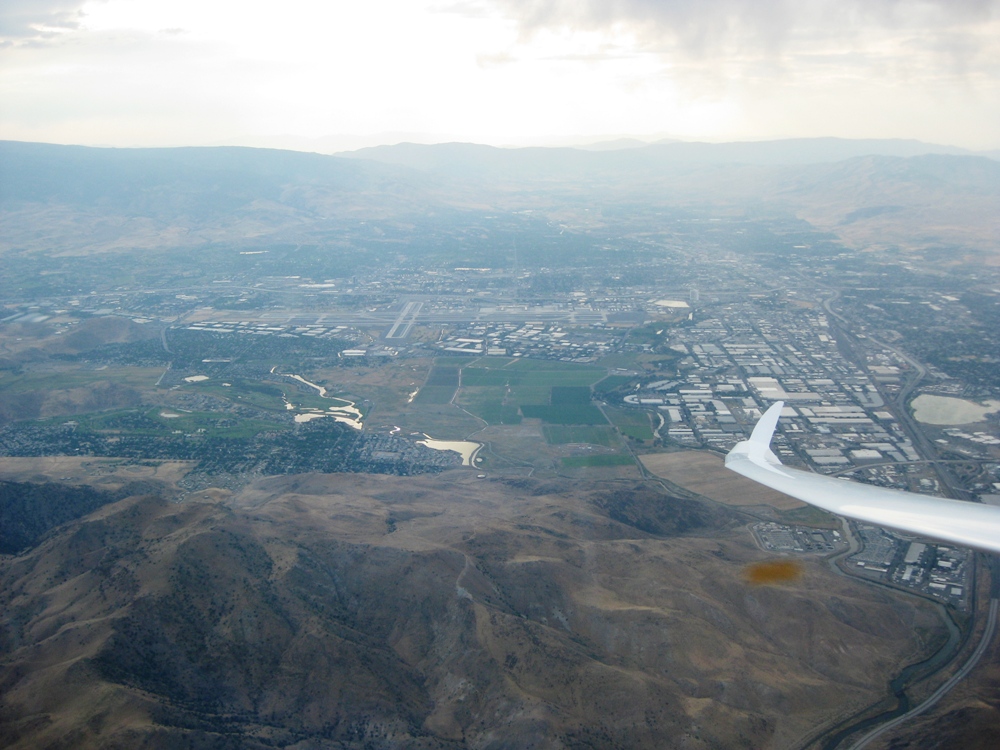
Ultimately we decided to try to get back to Minden. Here we are passing to the east of Reno/Tahoe International Airport. Rick had contacted them over the radio and informed them that we might have to overfly their airspace. We had been listening to them reporting our position and altitude to the arriving and departing airliners.


In the end, we stayed to the east of the airport and hoped for one more thermal as we continued south toward Minden. One more thermal, just a splash of gas, and we would be home free! But could we find it? No.

We crossed the Virginia Mountains and flew right over Virginia City as we headed to Carson City. The "V" in this photo is right above Virginia City.


Once we arrived at Carson City, Rick demonstrated the resilience of a great competition pilot and continued to search for that one last elusive thermal that would get us home. To no avail however, and we landed at Carson City. We only had to wait about 15 minutes before the tow plane arrived to tow us back to Minden.

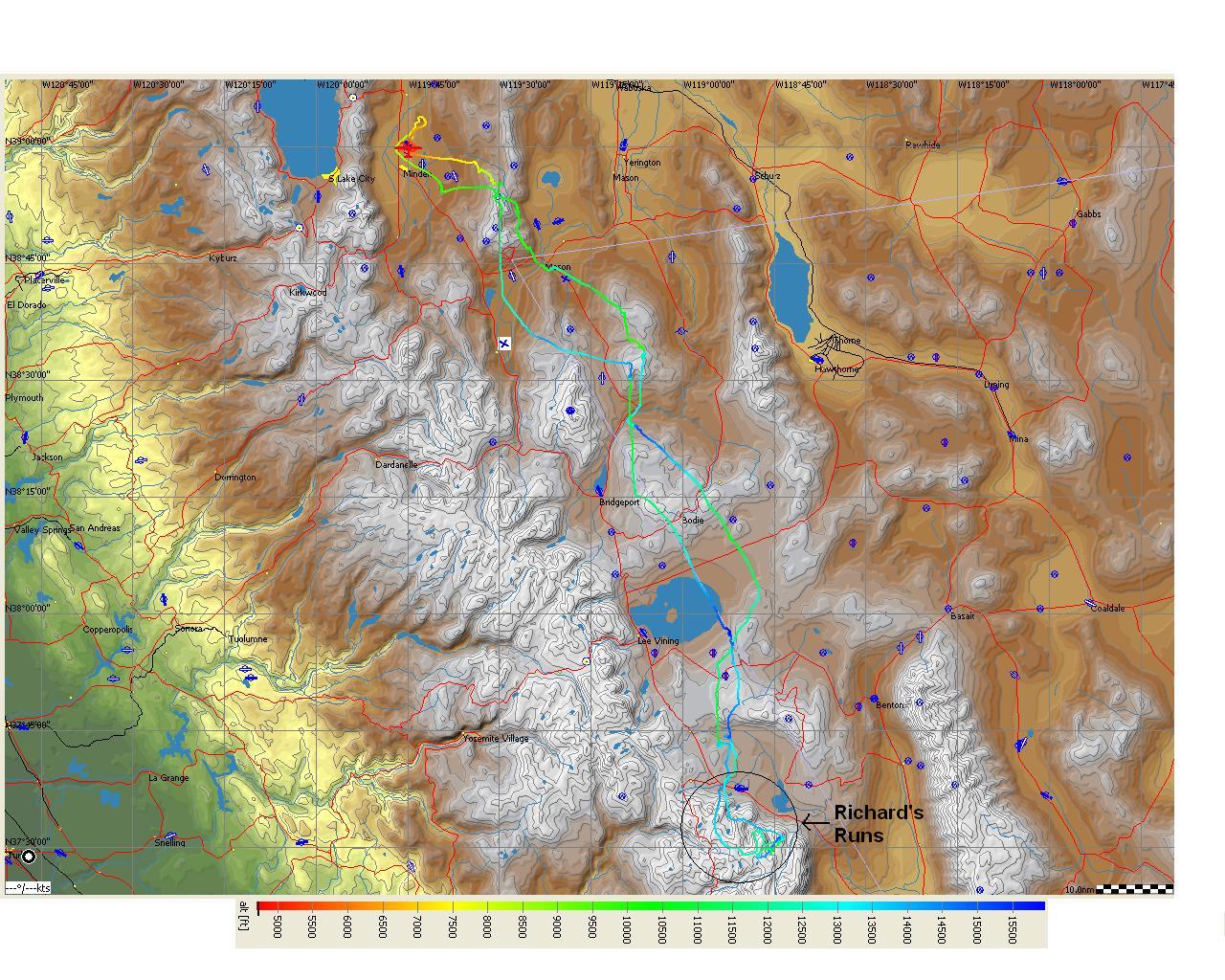
Those of you who have been following this blog know that the flights I have written about here were primarily flights to the south of Minden. Going that far to the north was a brand new experience for me. The flight lasted 5.6 hours and we covered about 350 miles.

My thanks go out to Rick and SoaringNV for another fantastic soaring experience!

Saturday, July 30, 2011

Third Minden Flight of 2011

I paid my second visit of the 2011 soaring season to Minden, NV and flew on Saturday, July 16, 2011 with Devin Bargainnier of SoaringNV in their Schempp-Hirth Duo Discus X.

I made this trip with a heavy heart as my Dad, Richard, had just passed away on July 3. It was somewhat of an untimely death (are they ever timely?), but not completely unexpected as Dad's health was in decline. In fact, my parents were in the process of moving to a lower elevation because of Dad's health when he died. So, after spending two weeks at Mom's house getting affairs in order, things were finally stable enough that I took a much needed break and went to do what I know Dad would have wanted me to do.

We had hoped to fly to Mt. Whitney on this day, but the day was not strong enough and we got a relatively late start. So instead, we flew to the south and made it a little past the Mammoth Mountain Ski Area.

Once we arrived, we could see that the lift line extended a little west into the Sierras. So we took this opportunity for a little sight seeing excursion. We knew that we wouldn't have much opportunity for extended dances in the Sierras as the lift markers were few and scatterd. In addition, the cloud bases weren't much higher than the mountain peaks. But we made two runs into the Sierra's separated by a return trip to the "gas station" to fill-up again before the second run. I have named these "Richard's Runs" in honor of my Dad.

I will dispense with my usual diatribe and let the photos tell the story of Richard's Runs. I'll just say to pay particular attention to the high-speed, low pass over the frozen lake with the turquoise blue shoreline. Enjoy, I know he did!


All too soon, Richard's Runs came to an end as we knew we would have to start back to Minden while the "gas stations" were still open. Here we are filling up at the Mammoth Lakes gas station right by the airport and Lake Crowley before beginning the journey back.


We proceeded north and filled up again at the southeast corner of Mono Lake. We put enough in the tank this time that we could make a beeline straight across the lake and head for the next gas station, which the sign said was forty miles away near Mt. Patterson. The wind on the lake was strong enough that its direction is clearly evident.


We approached the ghost town of Bodie, which I had flown over a number of times but had never taken a picture of as we were always too high.  In the first photo, Bodie is ahead of us on the right.  And in the second photo, it is near the wingtip.


It turns out that the Mt. Patterson gas station was closed when we arrived, but fortunately we found one still open near Gimmey's Bowl just a few more miles up the road. And it had a nice clean restroom to boot! That was all the gas we needed to get back home.

Here's our flight trace from See You.


What a wonderful flight to celebrate my Dad's life! The flight was 4 hours and 20 minutes in duration and we covered about 350 miles. But the 20 minutes that were Richard's Runs were definitely the highlight of the journey!

Epiblog

There aren't enough words to tell you what a wonderful person my Dad was. He was at times my mentor, my coach, my role model, my cheerleading squad, and most of all, my friend. I will consider myself successful if I can be half the person he was in life.

We only took to the skies together once, and he seemed to really enjoy it. I look forward to many more great flights with him in the future as I know he will always be with me.


Thursday, September 9, 2010

Fifth and Sixth Minden Flights of 2010

I paid my fourth visit of the 2010 soaring season to Minden, NV and flew on Saturday and Sunday, August 14-15, 2010 with SoaringNV in their Schempp-Hirth Duo Discus X.

Once again, I flew with Kenny Price and Devin Bargainnier. This time I flew with Devin on Saturday and Kenny on Sunday.

 Day 1 - Saturday, August 14, 2010

Devin and I decided that we would attempt to fly to Mount Whitney, and farther south if possible. It was not possible. Not only to fly farther south of Mount Whitney, but the day was not strong enough to even get there.

Although it was mid-August, there was still a surprising amount of snow in the Sierras.


We made our way to the south, down to Mammoth Lakes Ski Resort south of Mono Lake.


This is looking east. The large lake in the distance is Lake Crowley and Mammoth Lakes Airport is between it and the small lake, running parallel to HWY 395. Boundary Peak is the the white peak to the far east on the White Mountain Range (see last post).


This is Blood Mountain. Hmmm, I wonder why they call it that.


As we rounded Blood Mountain, another spectacular sight came into view (which happens every time I go down the Sierras!). A vein of gray granite infused into the red mountain at the right in the photo provided an interesting contrast.


Here it is as we got closer and following it to the west.


As we crossed the the next ridge, the most beautiful alpine lake I had ever seen came into view. It is Dorthy Lake. I thought I was seeing it for the first time. As I researched the name of this lake, I realized that I had seen it last year from a different perspective.


Dorothy Lake is at the bottom of this photo, and Lake Genevieve is to the upper left.


This is a photo from the first time I saw Dorothy Lake. It was last year, when I flew with Gavin Wills on my first ever trip to Mount Whitney during SoaringNV's first cross-country camp. This view is from much higher, and from the east looking west. Dorothy Lake is the large lake to the left and Lake Genevieve is the lake at the right of the photo. The smaller lakes above Lake Genevieve are Edith Lake and Cloverleaf Lake. This is my favorite soaring photo I have taken to date and serves as my desktop background.


We crossed a saddle in the granite infused mountain and then began a search for another "gas station". I had to remind Devin of the three rules of mountain flying!


We united with Mike Harrbison, a.k.a. "Mountain Mike" here and set-up for a photo opportunity. Mountain Mike is one of the most experienced fliers of the Sierras ever, and hence how he earned his nickname.


We continued together a little farther south, and then decided that we were not going to attempt Mount Whitney this day. We turned around and began the trip north back to Minden. Here we are at Tioga Pass (HWY 120), which leads out of Yosemite National Park and connects with HWY 395 near Mono Lake. The lake at the bottom of the photo is Ellery Lake and the lake at the top of the photo is Tioga Lake.


We continued north and found that the conditions were right to do something I had never done before. Fly into the Lake Tahoe basin. The big cumulus cloud in front of us would, in theory, provide us enough gas in the tank to venture over to Emerald Bay at the southwest corner of Lake Tahoe.


Here's a few shots of South Lake Tahoe as we are "filling up" before making the trip to Emerald Bay.


We actually flew farther west of Emerald Bay. These photos were taken as we returned to the "gas station" before we headed back to Minden.


Here's our flight trace from See You.


And here it is in Google Maps.


Day one totals: Flight time - 4.5 hours, Distance covered - 344 miles

Day 2 - Sunday, August 15, 2010

I didn't take any photos during this flight. Kenny and I flew down to the ghost town of Bodie, and then started towards Mount Grant. However, the cloud bases at Mount Grant were much lower than our current altitude. So we decided not to continue all the way there. Instead, we returned to the Pinenuts and continued north up to Rawe Peak. We then ran the length of the Pinenuts back down to the south end and decided to cross the Carson Valley to the Sierras.

We found no lift on southbound journey down the Pinenuts, nor during the first half of the crossing of the Carson Valley. We had travelled about 30 miles since leaving the last gas station and were starting to get low. It looked like the flight was coming to an end when we found a mild thermal that took us back up to ~12,500 MSL. So with all this new found gas we continued over to the Sierras and, for the second day in a row, flew into the Lake Tahoe basin before returning to Minden.

Here's our flight trace from See You.


And here it is in Google Maps.


Day two totals: Flight time - 4.4 hours, Distance covered - 316 miles

Another very special thank you to Kenny, Devin, and SoaringNV!